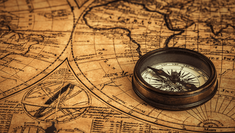
Navigating Without GPS: Old-School Techniques for Modern Travelers
Discover reliable old-school navigation techniques to stay oriented anywhere. Learn maps, compasses, nature cues, and practical skills for travel without GPS.
SURVIVAL SKILLSMOST RECENT
Table of Contents:
Why Navigating Without GPS Still Matters Today
Reading Maps with Confidence
Using a Compass: Simple Techniques for Accurate Direction
Nature’s Navigation Tools
Mental Mapping and Situational Awareness in Unfamiliar Places
Real-World Scenarios: Navigating Cities, Forests, and Open Terrain
Conclusion
In an age where a smartphone can guide us through any street, trail, or country, it is easy to forget that navigation was once a human skill, practiced, refined, and deeply trusted. Today, we rely on GPS for everything from daily commutes to international travel. Yet this convenience comes with a hidden cost: the gradual weakening of our internal sense of direction and our ability to interpret the world around us. GPS fails, batteries die, signals disappear, and technology isn’t always accessible. When that happens, old-school navigation techniques become not just helpful, but essential.
Relearning how to navigate without GPS is more than a survival skill. It is an exercise in awareness, independence, and confidence. Traditional methods (reading maps, using a compass, observing the sun and stars, or simply paying closer attention to one’s surroundings) develop cognitive abilities that modern tools often replace. Studies in cognitive psychology indicate that excessive reliance on GPS can lead to reduced spatial memory and a decline in hippocampal volume over time, whereas active navigation enhances memory, improves mental mapping, and facilitates better decision-making. By practicing these older skills, travelers sharpen their minds and become more engaged with the environment they move through.
These techniques also reconnect us with a long human history of exploration. For thousands of years, sailors crossed oceans guided by the stars alone. Desert travelers relied on dunes, winds, and shadow angles. Indigenous communities used trees, rivers, and animal tracks as natural signposts. Learning these methods today gives travelers a deeper appreciation for the landscapes they explore and a richer understanding of geography and nature. It transforms movement from a passive following of directions into an active journey.
Beyond the practical and historical value, old-school navigation encourages a slower, more intentional style of travel. It invites you to observe the terrain, notice patterns, and trust your senses. Instead of depending on a device, you rely on yourself. This shift brings a sense of freedom that many modern travelers rarely experience. Whether you are hiking, driving in remote areas, or navigating a new city, knowing how to stay oriented without digital tools allows you to move confidently and safely.
This guide will walk you through the timeless methods that helped people navigate long before technology existed, and that still work anywhere in the world today. From reading maps to interpreting the sky, from recognizing natural landmarks to building strong mental maps, each section offers practical steps to strengthen your navigation skills. By the end, you will be equipped with reliable, GPS-free strategies that enhance your travels and deepen your connection to the world around you.
Why Navigating Without GPS Still Matters Today
For many travelers, paper maps feel outdated, yet they remain one of the most reliable navigation tools ever created. A well-designed map works without batteries, signals, or software updates, and learning to read one builds a stronger understanding of distance, terrain, and direction. Map-reading is a foundational skill that strengthens spatial awareness and prepares travelers for situations where digital tools are unavailable.
Understanding Map Orientation
Most modern maps are drawn with north at the top, but this only becomes useful when you align the map with your actual surroundings. By holding the map so the north arrow points toward true north, using either a compass or visible cues like the sun, you ensure that the landscape matches what you see on paper. This simple habit dramatically improves your accuracy and prevents the common error of navigating with a sideways or reversed map.
Interpreting Symbols and Legends
Maps use a universal visual language to represent roads, rivers, trails, elevation, and landmarks. Learning the meaning of color codes, line types, and icons allows you to extract detailed information at a glance. For example, contour lines show elevation changes; closely spaced lines indicate steep terrain, while wider gaps signal gentler slopes. This information helps travelers anticipate effort, choose safer routes, and estimate how long a journey might take.
Understanding Scale
Maps use ratios, such as 1:25,000 or 1:50,000, to show how real-world distances translate onto the page. A map with a larger scale displays more detail, making it suitable for hiking or city navigation, while smaller-scale maps cover larger areas but with fewer features. Understanding scale allows you to measure distances accurately, estimate travel times, and avoid underestimating how far you really need to go.
Pathfinding on a map blends observation with planning. Instead of focusing on each turn, look for major features, rivers, ridges, highways, or coastlines, because these act as reliable anchors. Identify your starting point, your destination, and several “checkpoints” along the way. As you move, compare what you see with the features on your map. This technique prevents disorientation and builds a stable mental model of the route.
Maps also encourage strategic thinking. When travelers depend only on GPS, they often follow directions passively, meaning they follow on-screen instructions without thinking about where they are, how the route works, or what surrounds them. In contrast, map users must interpret the terrain, evaluate alternatives, and make decisions based on available information. This active engagement not only strengthens cognitive skills but also makes travel more purposeful and enjoyable.
Mastering the basics of map reading is an important step toward navigating confidently without digital tools. It reconnects you with geography, builds independence, and prepares you for environments where technology may not function. Once you understand how to orient a map, decode its symbols, and translate distances, you gain a dependable skill that serves you on every journey, whether in a city, a forest, or a remote landscape.
For more explanation about how to interpret symbols, legends, and scales, watch these two videos:
How to Read a Topo Map (3:47 minutes)
Beginner's Guide to Using a Map (5:54 minutes)
Reading Maps with Confidence
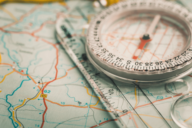
A compass is one of the most dependable navigation tools ever created. It works in every environment, does not require batteries, and provides a stable reference point when landmarks or visibility are limited. For modern travelers accustomed to digital devices, learning to use a compass may feel unfamiliar at first, but the technique is straightforward and becomes intuitive with practice. Mastering it builds confidence and ensures you can orient yourself accurately in any situation.
The Core Function of A Compass
The core function of a compass is to show direction by aligning a magnetic needle with the Earth’s magnetic field. The needle's red tip always points towards magnetic north. Everything else you do with a compass begins with this simple understanding. To use it effectively, hold the compass level in your hand, not tilted, and allow the needle to settle. Once the needle stabilizes, you can orient yourself relative to the four cardinal directions: north, south, east, and west.
To take a bearing, rotate the compass housing until the direction-of-travel arrow aligns with where you want to go. Then turn your body until the magnetic needle lines up with the orienting arrow inside the housing. At that moment, the compass is “set” to your chosen direction. This allows you to walk toward your destination even when the terrain curves or visibility decreases. As long as you keep the needle aligned with the orienting arrow, you remain on course.
Combining A Compass with A Map
Combining a compass with a map creates a powerful navigation system. Start by placing the compass on the map so its edge connects your current position to your intended destination. Rotate the compass housing until the orienting lines match the north-south grid on the map. Then, turn the map and compass together until the magnetic needle aligns with the orienting arrow. Now, the map is correctly oriented, and the direction-of-travel arrow points toward your actual route. This technique bridges the gap between what you see on paper and what you experience in the real world.
A compass is especially helpful in environments where landmarks are limited or misleading. Dense forests, deserts, foggy conditions, or urban areas with repetitive structures can cause disorientation. In these situations, the compass provides a fixed reference that prevents drifting off your route. It also helps correct small directional errors that accumulate over time, errors that can significantly impact long-distance travel.
Using a compass also strengthens spatial reasoning. Unlike GPS, which delivers constant instructions, working with a compass requires you to understand orientation, visualize direction, and make decisions actively. This engagement improves your internal navigation abilities and reinforces the mental map you are building while moving through the landscape.
For any traveler seeking independence from digital tools, the compass is an essential ally. It is reliable, precise, and surprisingly simple to master. Whether you are hiking, exploring a remote location, or navigating an unfamiliar city, knowing how to use a compass ensures that you can maintain direction confidently and safely, no matter the conditions.
For more explanation about how to use a compass with a map, watch these two videos:
How to Use a Compass (7:15 minutes)
THIS is How to Use a Compass and Map (9:18 minutes)
Using a Compass: Simple Techniques for Accurate Direction
Long before the invention of compasses or digital navigation, humans relied on nature to find their way. These natural cues are still reliable today, offering orientation even when technology fails. Learning to read the sky, shadows, wind, terrain, and environmental patterns empowers travelers with timeless skills that work anywhere in the world. These methods are simple, require no equipment, and strengthen your awareness of the environment around you.
Using the Sun for Direction
The sun remains one of the most accessible navigation tools. It rises generally in the east and sets in the west, creating a dependable east–west reference. Around midday in the Northern Hemisphere, the sun sits toward the south, which helps determine the other cardinal points. A simple shadow-stick method can confirm direction: place a stick upright in the ground, mark the tip of its shadow, wait 10–15 minutes, then mark the new shadow tip. The first mark represents west; the second represents east. Drawing a line between the two gives a clear east–west axis that you can use to orient yourself.
Guidance from the Stars
At night, the North Star (Polaris) has guided travelers for centuries because it sits almost directly above the Earth’s northern axis. To find it, locate the Big Dipper (Ursa Major), draw a line through its two outer stars, and follow that line upward until you see Polaris. Once found, it indicates true north. In the Southern Hemisphere, travelers can use the Southern Cross constellation to approximate south by extending the long axis of the cross downward toward the horizon. These celestial cues offer reliable orientation in open landscapes where other references are limited.
Interpreting Shadows
Shadows shift consistently throughout the day, providing directional cues even without full sunlight. In the morning, shadows point west; in the afternoon, they point east. As the sun climbs higher, the shadow length decreases, then grows longer again toward evening. Observing these patterns helps you estimate time, direction, and even terrain orientation. Travelers can use shadow movement to stay on track when hiking, navigating open ground, or estimating distance relative to their route.
Reading the Landscape
Natural landmarks often reveal direction without any tools.
Mountain
Slopes in many regions receive more sunlight on their southern faces, making them drier and more open, while northern slopes remain cooler and denser with vegetation.
Rivers
Usually flow downhill toward larger bodies of water.
Prevailing winds
Shape trees in consistent ways; bent branches, moss growth, and exposed roots can indicate dominant wind directions.
In deserts,
Dunes form patterns shaped by prevailing winds, giving clues about orientation and travel routes.
Observing Weather and Environmental Patterns
Cloud movement, wave direction along coastlines, and animal behavior can provide indirect guidance. Birds often fly toward water sources at dawn and back toward nesting areas at dusk. Waves along a shoreline generally hit perpendicularly, helping you estimate the coastline’s orientation. Even the moon’s path follows a predictable east-to-west arc, offering nighttime cues when stars are difficult to see.
Learning to interpret nature’s navigation tools enriches your travel experience by grounding you in your surroundings. Instead of relying on digital instructions, you read the world itself; its light, patterns, and textures. These cues work in every environment, from forests and mountains to deserts and coastlines. They also build a deeper connection to the landscapes you explore and provide a dependable backup when modern technology is unavailable. With practice, these natural signals become intuitive, helping you move confidently and independently wherever your journey takes you.
For more explanation about how to use Nature’s Navigation Tools, watch these videos
Sun Compass Shadow Stick Method (9:04 minutes)
How To ALWAYS Find The NORTH STAR (6:16 minutes)
Nature’s Navigation Tools
Strong navigation is not only about tools; it is also about how your mind interprets space, movement, and patterns. Mental mapping and situational awareness are cognitive skills that enable travelers to understand their current location, visualize their intended destination, and remain oriented even in complex environments. These skills operate quietly in the background, yet they are essential for safe and confident travel without the aid of GPS.
Building a Mental Map
A mental map is the internal picture your brain creates of an area. It includes roads, landmarks, distances, and the relationships between places. When travelers rely solely on GPS, this mental map often remains weak because the device does all the decision-making. Without effort, the brain does not actively record the route.
To strengthen your mental map, begin by observing the major layout of the area before moving. Identify a few anchor points, such as a river, a long road, a mountain range, or a tall building, and use them as reference markers. As you travel, pay attention to the sequence of turns, the direction you are heading, and how landmarks relate to one another. This habit transforms passive movement into an active understanding of place, making it easier to retrace your path or navigate even after unexpected detours.
Practicing Situational Awareness
Situational awareness involves paying attention to what is happening around you, both visually and spatially. Instead of focusing on a screen, look outward. Notice the shapes of streets, the flow of traffic, the orientation of buildings, and how people move through the area. These observations help you detect patterns and anticipate what comes next.
Good situational awareness reduces confusion, prevents getting lost, and enhances personal safety. For example, recognizing a distinct building on your way into a neighborhood makes it easier to find your way out. Noticing how shadows fall on a trail helps you confirm direction. Even the color or texture of terrain changes can alert you that you have veered from your intended path.
Using Landmarks Effectively
Landmarks are powerful navigation aids when used correctly. Choose features that are large, visible, and unlikely to change, such as towers, bridges, hills, or significant trees. Avoid relying on temporary features such as small signs or parked cars. When walking or driving, regularly look behind you to see how the route appears from the opposite direction; this helps tremendously when returning the same way later.
Try grouping landmarks into sequences. Instead of remembering one point at a time, think: "From the river, walk toward the tall building, then turn left at the bridge." This creates a smoother and more memorable route.
Keeping a Sense of Direction
Developing a natural sense of direction takes practice. Start by noting which direction you are facing when you begin your journey. Check the sun, street orientation, or position of landmarks to confirm whether you are moving north, south, east, or west. As you proceed, update your internal compass by observing how your position relates to major features. This habit not only supports your mental map but also boosts confidence, especially in large cities or remote areas.
Handling Uncertainty
Even skilled navigators encounter moments of uncertainty. The key is not to panic. Stop, observe the environment, and reconnect with your reference points. Look for prominent landmarks, listen for traffic flowing toward central areas, or refer back to natural cues like the sun’s position. These simple steps help you regain orientation quickly and safely.
Mental mapping and situational awareness transform navigation from a mechanical process into an intelligent, conscious interaction with your surroundings. They make travel more intuitive, reduce reliance on technology, and contribute to a deeper understanding of the places you explore. With consistent practice, these skills become second nature, empowering you to move confidently through any environment, even without digital tools.
Mental Mapping and Situational Awareness in Unfamiliar Places
Knowing how to read maps, use a compass, and interpret natural signs is valuable, but the true test of navigation skill is applying these methods in real environments. Cities, forests, deserts, and open terrain each present unique challenges. Understanding how to adapt your approach to each setting ensures you can travel confidently, even when GPS signals are weak, unavailable, or inaccurate.
Navigating in Cities
Urban environments may seem easier to navigate because of signage and structured layouts, but they can also be disorienting. Tall buildings block the sun and disrupt your sense of direction, while similar-looking streets and heavy traffic create confusion.
To navigate cities effectively without GPS:
Identify major reference points such as rivers, parks, tall landmarks, or main avenues. These serve as anchors in your mental map.
Check building shadows to estimate direction. Even in cities, the sun still creates predictable patterns.
Use public maps and transit stations as orientation hubs; they often display a north-facing layout.
Look behind you often to memorize return routes from the opposite direction.
Cities require constant situational awareness because environments change quickly. Active observation helps you stay oriented and confident when moving through complex urban spaces.
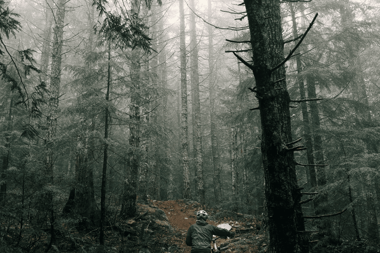
Navigating in Forests
Forests are some of the most challenging places to navigate without technology. Dense trees block long-distance vision, trails can look similar, and paths naturally curve. However, with careful preparation and awareness, you can navigate safely.
Key strategies include:
Use a compass frequently to maintain your bearing, especially when the path is unclear
Identify natural markers such as streams, ridgelines, or distinctive trees to use as reference points.
Pay attention to terrain changes. Elevation shifts and slope directions help confirm your route.
Mark your path using safe, low-impact methods such as noting unique features rather than disturbing the environment.
Avoid drift: Without a compass, most people unintentionally walk in gentle circles; checking direction often prevents this
Forests require patience, discipline, and continuous attention to surroundings. When used together, maps, compasses, and nature cues give you full control of your route.
Navigating in Open Terrain
Open terrain, such as deserts, plains, grasslands, or coastal areas, can feel limitless. With few landmarks and vast distances, travelers may underestimate orientation challenges.
To navigate open spaces:
Use the sun or stars to maintain a consistent direction over long distances.
Take compass bearings before moving and recheck them frequently.
Identify distant features such as mountains, dunes, or isolated structures and head towards them as checkpoints.
Observe wind and sand patterns in deserts; they often show dominant wind directions.
Track your own footprint patterns when possible. In sand or snow, your trail becomes a helpful visual reference.
Open landscapes reward disciplined navigation. Without trees or buildings, the sky becomes your guide, and learning to read it allows you to move confidently across large, uninterrupted spaces.
Combining Techniques for Safety
In real-world scenarios, no single method should be used alone. The strongest navigation strategies involve combining:
Compass bearings
Natural cues
Landmarks
Mental mapping
Situational awareness
Together, these methods reinforce each other and lower the chances of misdirection. Even if one cue becomes unreliable, the others keep you on track.
Navigating without GPS is ultimately about balance; balancing tools, instincts, and awareness to build a reliable, independent navigation system. Whether you are exploring a new city, hiking through a forest, or crossing open terrain, these skills empower you to move with clarity and control in any environment.
Real-World Scenarios: Navigating Cities, Forests, and Open Terrain
Navigating without GPS is more than a collection of old techniques; it is a mindset. In a world where technology handles so many aspects of daily life, choosing to rely on your own awareness, judgment, and skills is an empowering form of independence. These traditional navigation methods remind us that the world is readable and that we can interpret it with our senses, reasoning, and intuition.
By learning how to read maps, use a compass, observe natural cues, and build strong mental maps, you reconnect with abilities that have guided humanity for centuries. These skills sharpen cognitive performance, enhance memory, and foster a deeper relationship with the environments you explore. More importantly, they ensure that you remain capable and confident even when technology fails—whether due to battery loss, weak signals, remote locations, or unexpected situations.
Practicing these navigation techniques encourages a more intentional and present style of travel. Instead of following instructions passively, you engage with the landscape, notice patterns, and make informed decisions. This active involvement transforms every journey into a learning experience, strengthening your sense of direction and your trust in your own abilities.
In an era of constant digital support, choosing to navigate naturally is a reminder of what you can accomplish on your own. It is a step toward greater resilience, clarity, and self-reliance. Whether you are hiking a trail, exploring a new city, or traveling across unfamiliar terrain, these old-school methods provide a timeless foundation that will serve you anywhere in the world.
Rediscovering these skills does not mean rejecting technology; it means supplementing it with the wisdom and awareness that modern tools often replace. By combining both, you become a more capable traveler, ready to adapt, confident in uncertainty, and deeply connected to the world around you. This balance is the true essence of navigation: understanding where you are, recognizing where you are going, and moving forward with confidence, no matter what tools you carry.
Conclusion

Watch: In this TED talk, Tristan Gooley, known as "The Natural Navigator," reveals how to read nature's hidden signs, from the shape of trees to the behavior of rivers, to find your way and reconnect with the world around you.